Showing posts with label NWS. Show all posts

Colorado Daily Status Report: July 18, 2022

Colorado Daily Status Report Link to the full report.


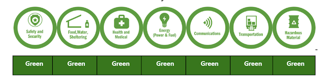
logo showing community life lines circles

State Emergency Operations Center (SEOC) Status Level 3

The SEOC transitioned to Level 3. SEOC continues to support of the following: COVID-19 recovery, Marshall Fire recovery and HPAI. The SEOC is operational Monday through Friday from 8 a.m. to 5 p.m. 

Colorado Joint Field Office: Activated with support from DHSEM and FEMA staff to support major disaster DR4634 Boulder Fires and Straight-Line Winds.

Highly Pathogenic Avian Influenza (HPAI)

The Colorado Department of Agriculture (CDA) and USDA are coordinating the state response to HPAI cases in the state. Use the CDA website and map below for resources and information updates. A situation report will be posted on the CDA HPAI webpage each Friday.

Current Wildfires

  • None Reported

View the Colorado Current Wildfires Map. No current large wildfires being monitored by SEOC.


Daily Status Report

Download or view the daily status report: https://bit.ly/COStatus071822


Colorado Flood and Wildfire Awareness Week

Flood and wildfire season is approaching. You should know your risks and make your plans to improve your outcomes.

The National Weather Service wants everyone in the United States to be part of a Weather-Ready Nation. Colorado has more than its fair share of floods, flash floods, and wildfires. You should be weather alert and weather-ready, knowing how to stay safe when floods and wildfires affect your area.

Governor Hickenlooper has proclaimed this week, March 12th through 26th, as Colorado Flood Safety and Wildfire Awareness Week. Now is the time to learn about flood and wildfire risks in Colorado, and to develop your plans to improve your outcome.

Floodprone areas have been identified in over 250 cities and towns and in all 64 counties in Colorado. Over 250 thousand people live in floodplains in Colorado. There are estimated to be 65 thousand homes and 15 thousand commercial, industrial, and business structures in identified floodplains. There are likely many more structures located within unmapped flood hazard areas. The value of the property, structures, and contents located in the identified floodplains is estimated to be around 15 billion dollars.

Floods and flash floods have killed over 400 people in Colorado since the turn of the 20th century. The historic weather pattern of September 2013 reminds us all that floods are a major concern across the Centennial State. Floods have caused billions of dollars of damage in Colorado.

On average, 2500 wildfires occur across Colorado each year. Since 2012, 8 people have been killed when wildfires occurred in the wildland-urban interface (WUI).

The National Weather Service forecast offices which serve Colorado will issue a series of public information statements during this Colorado Flood Safety and Wildfire Awareness Week...covering the following topics.


More information on floods and wildfires is available at your local National Weather Service web sites.

DHSEM and State EOC Continue to Monitor Weather Conditions on July 30

The State Emergency Operations Center remains at a Level IV activation.  At 11 a.m. the Division of Homeland Security and Emergency Management staff participated in a conference call with the National Weather Service Pueblo Forecast Office and local emergency managers for an update on current and predicted weather for the state. The State EOC staff will continue to monitor the weather and are ready to support local jurisdictions as requested. The weather information for today is:


  • Conditions are more stable today than yesterday, however there is still low-level moisture.  If storms develop, they will be capable of producing heavy rain, potentially 1-2" per hour.
  • Conditions are stable over the plains and are unlikely to produce flash flooding, so the flash flood warning has been cancelled, but showers with localized flooding are still possible.
  • Heaviest areas will be the eastern mountains out to the I-25 corridor.
  • Primary concern is sun/warmer temperatures producing instability. The El Paso and Teller Counties are the areas of concern for instability. Showers could start in this area as soon as 12 - 1 p.m., but more likely 3 - 6 p.m.. The Waldo Canyon burn scar has a heightened threat.
  • East Peak Fire burn scar has a lower level of threat and will start later in the day.
  • There is some drying over the San Luis Valley so no watch currently in effect, but there will be the seasonal hit-or-miss showers.
  • Tomorrow will be drier, but instability can still lead to afternoon and evening thunderstorms over the eastern mountains and plains. No watch is set, but local flooding is possible.
  • Drying will continue into the weekend, then moisture returns next week, all typical for the monsoon season for Colorado.
  • Of note: expect a daily threat over the Waldo Canyon burn scar in to early September based on seasonal norms.

Colorado Lightning Safety Awareness Week: Lightning and Wildfires

Colorado Lightning Safety Awareness Week concludes today with wildfires being the final topic. During the past week we have presented lightning information and safety rules. Although wildfires are not an actual weather phenomenon wildfires are directly related to lightning and other weather elements.

Normally, the wildfire threat in Colorado increases significantly after the middle of June and usually peaks in early July...and remains high through August and early September. Colorado averages about 2,500 wildfires each year.

About half of all forest fires in Colorado are ignited by lightning. Additionally, many rangeland and wheatfield fires are caused by lightning. Many of these lightning caused wildfires occur in the absence of rain and are the result of what is referred to as dry thunderstorms.

Read the full blog post written by the National Weather Service at www.READYColorado.com.  

Colorado Lightning Safety Awareness Week: Medical Issues of Lightning Injuries


Colorado Lightning Safety Awareness Week continues through Saturday. Lightning safety information provided this week will hopefully help you avoid any encounters with lightning. Today we discuss lightning injuries.

The facts about lightning strike victims:
In Colorado cloud to ground lightning flashes occur nearly a half million times each year. With millions of visitors and extensive outdoor activities it is not surprising that three people are killed each year in Colorado and there are an average of 13 lightning injuries. While any death is tragic, injuries can be equally tragic and devastating to the family. For those who have a relative that suffers a significant disability from lightning life changes forever. In addition to the physical pain and mental anguish suffered by the victim and their family the incident may lead to a loss of income for the family. Over time, medical expenses for treatment may drain the assets of a family.


View the full blog post written by the National Weather Service at www.READYColorado.com

Colorado Lightning Safety Awareness Week: Safe Shelters and Indoor Lightning Safety


The week of June 22 through June 28 is Lightning Safety Awareness Week in Colorado and nationwide. This public information statement will discuss safe shelters and indoor lightning safety.

Statistics tell us that we are much less likely to become a lightning victim if we remain inside a substantial structure such as a home or office building when thunderstorms are nearby. In 2013, 23 people in the United States lost their lives after being struck by lightning and countless others were injured. While most people struck by lightning are outside in open areas such as ball fields, parks, golf courses, near water or some type of machinery, a small percentage of those killed or injured are indoors. Therefore it is important to discuss indoor lightning safety.

Read the full blog post written by the National Weather Service at READYColorado.com.  

Colorado Lightning Safety Awareness Week: Outdoor Lightning Safety

When Thunder Roars, Go Indoors

Colorado Lightning Safety Awareness Week continues through Saturday. Yesterday we discussed the science of lightning. Today we will cover outdoor lightning safety.

Outdoors is the most dangerous place to be during a thunderstorm. Each year, many people in the United States are struck by lightning while working outside, at sporting events, on the beach, mountain climbing, fishing, mowing the lawn or during other outdoor activities. In 2013, 23 people in the United States were killed and many more were survivors of a lightning strike. All of those lightning fatalities occurred outdoors.

In Colorado, since 1959 there have been 141 documented lightning fatalities and hundreds of others who were injured by lightning. In 2013 there were no documented lightning fatalities in Colorado. However, 22 people within the state were struck by lightning while outdoors and all survived.


Read the full blog post written by the National Weather Service at READYColorado.com

Colorado Lightning Safety Awareness Week: The Science of Thunderstorms and Lightning


Colorado Lightning Safety Week continues through this Saturday. Today we discuss the science of lightning. 

Every thunderstorm produces lightning.  Lightning is a giant spark that moves within the cloud, between clouds, or between the cloud and the ground.  As lightning passes through the air...it heats the air rapidly to a temperature of about fifty thousand degrees Fahrenheit.  This causes a rapid expansion of the air near the lightning channel.  This rapid expansion causes a shock wave that we hear as thunder. 


Read the full blog posting at READYColorado.com.  

Colorado Lightning Safety Awareness Week 2014


Governor Hickenlooper has proclaimed the week of 22 - 28 June as Colorado Lightning Safety Awareness Week. The Colorado Division of Homeland Security and Emergency Management, READYColorado and the Division of Fire Prevention and Control are partnering together this week with the National Weather Service to raise the awareness of lightning safety.  The National Weather Service will write daily blogs that will be posted on READYColorado.com each day.

Lightning strikes the ground in our state over a half million times each year...and with many of us participating in outdoor activities we need to learn how to protect ourselves from the lightning threat.

Lightning is also responsible for about half of the wildfires in Colorado each year. When lightning or other conditions are conducive to a high wildfire threat the National Weather Service will issue Fire Weather Watches or Red Flag Warnings. 

During this week a series of statements will cover a variety of topics related to lightning and wildfires: 
MONDAY:  LIGHTNING OVERVIEW
TUESDAY:  THE SCIENCE OF THUNDERSTORMS AND LIGHTNING
WEDNESDAY:  LIGHTNING SAFETY OUTSIDE
THURSDAY:  LIGHTNING SAFETY INSIDE
FRIDAY:  MEDICAL ISSUES OF LIGHTNING INJURIES
SATURDAY:  LIGHTNING AND WILDFIRES 


There are a couple of web sites that contain additional information.  Information on lightning across the United States can be found at:


Information on lightning statistics in Colorado is available at:

Colorado Severe Weather Awareness Week In Review

Thank you to our Colorado Forecast Offices:
  • Boulder/Denver
  • Grand Junction
  • Pueblo
  • Goodland
The warning coordination officers from each of our Colorado Forecast Offices have provided daily blogs this week to help our Colorado community prepare for severe weather hazards. 

Visit our READYColorado site for a final week in review blog for Colorado Severe Weather Awareness Week.

When Thunder Roars Go Indoors: Colorado Severe Weather Awareness Week

Thunderstorms produce some of the most dangerous weather on earth including tornadoes, flash floods, large hail and destructive straight-line winds. However, the most dangerous aspect of thunderstorms in Colorado is usually lightning.

Since 1980, lightning has killed and injured more people in Colorado than any other thunderstorm hazard with an average of three fatalities and 13 injuries each year. These numbers are probably higher as studies indicate that many lightning casualties, especially injuries, are not reported. In 2013, there were no documented lightning fatalities in Colorado. However, 22 people were struck by lightning within the state and all survived.

In addition to producing human casualties lightning also ignites most forest and rangeland fires in the centennial state. Many of these wildfires occur when lightning is generated from thunderstorms which produce little or no rainfall. This type of lightning is commonly referred to as dry lightning.

The safest thing for you to do if you are outside and lightning or thunder begins to occur is to immediately get inside a substantial building such as a house, a store or a church. A hard-topped vehicle such as a car or truck also offer excellent protection from lightning. Once inside a substantial building or hard topped vehicle keep all windows and doors closed and do not touch any metal inside the vehicle. It is then recommended that you wait at least 30 minutes from the last rumble of thunder before returning outside.

A recent lightning safety study has shown that 95 percent of the people who were struck by lightning while outdoors had a nearby substantial building or vehicle nearby. Remember, there is no safe place outdoors when lightning is occurring. Do not seek shelter under picnic shelters, dugouts, porches, tree, carports or tents. These types of structures are not safe when lightning is occurring.

Once inside a substantial building, stay off corded telephones and away from electrical appliances since the electrical discharge can travel along the telephone lines and electrical wires to produce fatal results. Stay away from water such as showers, tubs and sinks. Even indoor swimming pools are not safe when lightning is occurring. It is also recommended that you unplug sensitive electronics such as computers when lightning is expected to occur nearby.

The best defense to protect yourself against a lightning strike is to plan ahead and avoid being caught where you might be vulnerable. Check the weather forecasts prior to venturing out especially if you are heading into the mountains. Plan your outdoor activities for early in the day before thunderstorms typically develop. Stay tuned to NOAA all hazards weather radio and check the national weather service forecasts at www.weather.gov.

It is very important that all sports leagues and other outdoor groups have a lightning response plan that is understood and consistently applied for the safety of the participants. Part of the plan would include a designated weather watcher at each outdoor event with the authority to postpone or cancel the event due to the threat of lightning.

Remember, if thunderstorms threaten seek shelter in a substantial building or in an enclosed metal roof vehicle.

For more information on lightning safety please check out the web site www.lightningsafety.noaa.gov.

For more information about lightning in Colorado please go to the Colorado lightning resource webpage at www.weather.gov/pub/ltg.php.  


Straight Line Winds and Hail: Colorado Severe Weather Awareness Week

Strong straight line winds and large hail are major weather threats in Colorado.

During this Severe Weather Awareness week in Colorado remember that threats from thunderstorms include tornados, straight line winds, hail, flooding and lightning.

Tornadoes are often the headline story, but damaging straight line winds can also injure and kill animals and humans. These winds are usually caused by an area of air within a storm which is quickly cooled by precipitation or the evaporation of precipitation.

This area of cooled air which is heavier than the surrounding air accelerates downward. As the cool air slams into the ground it spreads out from the area of impact. This process, in extreme cases, in result in wind speeds exceeding 100 MPH. Weather forecasters call these winds microbursts if they are less than 2.5 miles across and macrobursts if they are greater than 2.5 miles across.

These downbursts of cool air can be life threatening to pilots and can cause extensive damage, injuries and deaths at ground level. Try to get indoors during all storms because high winds can suddenly develop causing things on the ground to become swiftly moving missiles that can injure or kill.

Hail often occurs in Colorado. Hail forms within storms as liquid water and freezes in the cold mid and upper levels of the storms. The hailstones are kept aloft by strong updraft winds for a time and then cascade to the ground. In Colorado hailstones vary from pea size around 3/8 of an inch in diameter to softball size around 4 1/2 inches in diameter.

Hailstones can do tremendous damage to crops either as large hailstones or as a large volume of small hailstones that accumulate to a depth of several inches. Large hail damages vehicles and buildings and can be life threatening to animals and people.

The National Weather Service issues severe thunderstorm warnings for winds of 58 MPH or higher or for large hail one inch in diameter or larger. When you hear about a severe thunderstorm warning move to shelter.

When thunderstorms threaten you this severe weather season tune to NOAA all hazards weather radio. Wherever you are during threatening weather plan out the actions you would take if severe weather were to strike.

Guest blog written by Tom Magnuson, Warning Coordination Meteorologist, National Weather Service, Pueblo, Colorado.

Flooding and Flash Flooding: Colorado Severe Weather Awareness Week

As we saw last September flooding can be a major problem in Colorado.

The flash flooding in September damaged a number of streams and mitigation is ongoing to remove debris and shore up heavily damaged areas along the streams in and near the foothills from Larimer County to El Paso County. The snowpack in the South Platte Basin is above normal so there is concern when the melt occurs that streams may not be able to handle a fast melt. The rate at which runoff occurs is dependent on a number of factors including the depth of the snow, how fast hot temperatures develop and whether thunderstorms drop heavy rain on the snowpack with runoff combining with falling rain. In 2011 we had a similar high snowpack with minimal flood issues as the warm days and cool nights moderated the rate of the snow melt. The peak snowmelt season is usually extends from late May through early June.

In September over eight inches of rain fell over a large area of the foothills from northern Jefferson to northern Larimer counties. All this rain filled area creeks and rivers causing considerable flash flooding. Runoff from area streams combined to cause major flooding along the South Platte River.

Flash flooding refers to dangerous sudden rise in water along a creek, river or over a normally dry land area. Flash floods result from heavy rainfall, sudden breaks in river ice jams and dam or levee failures. Flash floods can occur within a few minutes or hours and can move at surprisingly high speeds, striking with little warning. Flash floods are quite destructive because of the force of the moving water and the debris that accumulates in flood waters such as trees and boulders which can destroy roadways, bridges and buildings.

Other complications in Colorado are recent fires which raise the flood threat when locally heavy rain falls on recently burn scars. Residents in and near burned areas near Mancos, Debeque or in the Front Range Foothills from Larimer to El Paso Counties should plan ahead on response actions for flooding.

The National Weather Service will discuss flood and flash flood potential in daily hazardous weather outlooks and in the weather story on National Weather Service websites. On days with a high threat for flooding you may hear:

  • A flash flood or flood watch which means that flash flooding or flooding is possible within the watch area.
  • A flood warning which means that flooding is imminent or has been reported along a river.
  • A flash flood warning which means that flash flooding has been reported or is imminent. When a flash flood warning is issued for your area act quickly. If advised to evacuate do so immediately. Go to higher ground or climb to safety before access is cut off by flood waters.
  • An urban flood advisory will be issued for impact flooding that is not in itself life threatening. In an urban area if you were commuting during rush hour during a flood advisory you could expect some intersections to be underwater and a much longer commute. A small stream flood advisory might be issued when flow is bankful with minor lowland flooding along the stream.

Nearly half of all flash flood fatalities are vehicle related. Do not enter a flooded roadway, instead turn around, do not drown. In rapidly rising waters backing up away from water may be safer. One to two feet of water will carry away most vehicles and you also cannot tell if the road is damaged beneath moving water.

Colorado Severe Weather Awareness Week continues through this Saturday.


Tornadoes and Tornado Safety: Colorado Severe Weather Awareness Week

This is Colorado Severe Weather Awareness Week, a time when the National Weather Service reminds you of the hazards associated with thunderstorms. The topic for today is tornadoes and tornado safety.

The threat of tornadoes in Colorado increases rapidly in May and continues through August. Ninety percent of Colorado tornadoes occur during this four month period, but tornadoes have been reported as early as February and as late as October.

Tornadoes have been reported in just about all areas of the state, but historically 95 percent of Colorado tornadoes occur along and east of Interstate 25 where heat and moisture in the lower atmosphere are often more abundant. Tornadoes can occur at every hour of the day, but most occur between 1 p.m. and 8 p.m.

Across the country about 90 percent of tornadoes are considered weak with winds less than 110 MPH. Winds of this magnitude will damage a wood frame construction home but may completely destroy a mobile home or outbuilding. They typically have a life span under 10 minutes and result in less than five percent of tornado fatalities.

About 10 percent of tornadoes are considered strong with winds up to 165 MPH. Winds of this magnitude will cause considerable damage to most buildings. These tornadoes may last 20 minutes or longer and are responsible for nearly 30 percent of tornado deaths.

Violent tornadoes account for only one percent of all tornadoes, but they result in nearly 70 percent of all tornado fatalities because they destroy much of what is in their path. Violent tornadoes can last over an hour and travel over 50 miles before dissipating. The best chance of surviving a violent tornado is to be inside a safe room or underground shelter.

An easy phrase to remember for tornado safety is to get in, get down and cover up. Get inside a sturdy building, get down to the lowest floor or most interior room in that building and cover your head.

The best option for tornado safety is to be inside a well-built structure within a basement, safe room or underground storm shelter. If none of these options are available move to a hallway or a small interior room on the lowest floor such as a closet or bathroom. Cover yourself with blankets or get under a sturdy piece of furniture because the greatest risk of injury from tornadoes is from flying debris.

Abandon modular homes and mobile homes as they offer little protection from tornadoes. If a tornado approaches leave these locations and seek safety in a nearby building or storm shelter.

If you are driving in open country and see a tornado simply drive away from the tornado path if time permits. Do not take shelter beneath a highway overpass. If you are in an automobile and a tornado is fast approaching with little time for action either pull over and remain buckled in your vehicle while crouching down or abandon your vehicle and lie in a ditch or culvert away from your vehicle and protect your head.

If you are caught outside and cannot find a safe shelter crawl into a culvert or lie down in a narrow ditch and cover your head. But remember that these are poor, last-minute options because the worst place to be when a tornado threatens is outside in the midst of flying debris.

You can get the latest weather forecasts and severe weather watches and warnings from a local NOAA weather radio all hazards station and on the internet at weather.gov.

This guest blog written by David Floyd, Warning Coordination Meteorologist, NWS


Colorado Flood Safety and Wildfire Awareness Week in Review

Colorado has more than its fair share of floods, flash floods, and wildfires. Last year was particularly devastating, with numerous wildfires and many areas experiencing floods. During the past week, in our effort to build a Weather-Ready nation, we have presented information to you on how to stay safe and minimize property damage during flood and wildfire threats.

When a flash flood warning is issued for your area, you need to quickly move to higher ground out of drainages or other low spots. It may be just a short run or climb to that higher ground.

Nearly half of all flash flood fatalities occur in vehicles. Do not drive through a flooded roadway. Instead turn around, do not drown. The water may be much deeper than you think because it may not be possible to see below the surface of flood waters that the roadway has been washed away. One to two feet of water will carry away most vehicles. Additional flood safety information can be found at www.floodsafety.noaa.gov.

Areas burned by wildfires are highly susceptible to flash floods, especially within the first two or three years after the wildfire has occurred. Wildfires by themselves destroy much property and occasionally result in fatalities within Colorado. There are actions you can take to protect yourself and minimize the wildfire threat to your property.

If you live near or within a forest or rangeland you are encouraged to make a defensible space around your home and other structures. Information on how to make a defensible space around your home can be found on the Colorado State Forest Service website at http://csfs.colostate.edu/pages/defensible-space.html.

River flooding from snowmelt or persistent rainfall can cause extensive damage to property. There are estimated to be 65,000 homes and 15,000 commercial, industrial and business structures in identified floodplains within Colorado. FEMA has online maps that show if you are in a flood risk area. To access those maps go to https://msc.fema.gov.

If you live in a flood prone area, buying flood insurance is the best thing you can do to protect your home, your business, your family and your financial security. To find an insurance agent and obtain other flood insurance information, go to FEMA’s National Flood Insurance Program web site at www.floodsmart.gov.  As a reminder there is generally a 30-day waiting period from the time a flood insurance policy is purchased to when it goes into effect.

Additional information on floods and wildfires is available from your local National Weather Service web sites.

Preparedness and safety tips are available on floods, wildfires and other hazards in Colorado on the Colorado Division of Homeland Security’s community preparedness website: www.READYColorado.com. Information is also posted daily on Facebook at www.Facebook.com/READYColorado and on Twitter at www.Twitter.com/READYColorado.


This blog was written by Jim Pringle, Warning Coordination Meteorologist, WFO Grand Junction

Colorado Flood Safety and Wildfire Awareness Week: Flash Floods


Today’s topic during this Flood Safety and Wildfire Awareness Week is flash floods.    


Flash floods are no strangers to Colorado. Since the year 1900 nearly 300 people have been killed in flash floods across the Centennial State.  

Flash Flood History

In terms of lives lost the worst flash flood occurred on July 31, 1976 in the Big Thompson Canyon between Estes Park and Loveland.  A nearly stationary storm produced around 12 inches of rain in four hours claiming 144 lives.

Three other notable flash floods in Colorado were:

  1. In 1904 just north of Pueblo a bridge failed and around 100 people drowned when a passenger train plunged into Fountain Creek.
  2. Last year nine people drowned during the historic September rain episode, which was a combination of flash floods and river floods. These floods were much more extensive than the Big Thompson Canyon flood of 1976, but because of timely and accurate warnings many lives were saved.
  3. The 1997 Fort Collins episode killed five people and caused $200 million of property damage.

Flash Flood

A flash flood is defined as a rapid rise in water levels generally occurring in less than six hours along large creeks, normally dry washes, arroyos or over normally dry land area and can occur with little advanced notice.  

Flash floods frequently result from high rainfall rates and infrequently result from dam failures, levee failures or sudden breaks in river ice jams.  Flash floods are very destructive due to the force of the moving water and the accompanying debris. This tremendous force can easily damage or destroy roadways, bridges and buildings. 

In recent years Colorado has seen major flooding and damage when heavy rains have occurred on wildfire burn scar areas.  If you are in or near a burn scar area you need to plan ahead.  Be aware of general flash flood plans and procedures that have been developed and implemented by your local emergency management officials. You should know your flash flood risks and make your plans to save your life and those around you.

The National Weather Service forecast offices will discuss flash flood potential in Daily Hazardous Weather Outlooks and in Graphical Weather Stories on National Weather Service forecast office web sites. 

During days when flash flooding is possible a flash flood watch will be issued.  

During days when flash flooding is likely or occurring a flash flood warning will be issued. 

When a flash flood warning is issued for your area you need to act quickly if you are in a drainage area or in other low spots.  Know your escape routes to higher ground and act as quickly as possible. It may be just a short walk or climb to that higher ground.

Many flash flood deaths occur in vehicles.  Do not drive through a flooded roadway.  The water may be much deeper than you think because the roadway may be damaged or washed away. One to two feet of water will carry away most vehicles. Instead turn around, don’t drown.  

For more information on flood safety go to Http://www.floodsafety.noaa.gov.

Flood Safety and Wildfire Awareness Week continues through this Saturday. 

This blog written by Tom Magnuson, Warning Coordination Meteorologist, National Weather Service Pueblo

NWS Shares the Types of Flooding that Occur in Colorado


Colorado Flood Safety and Wildfire Awareness Week:  Types of Flooding


Flooding can be a major problem in Colorado as we saw recently in September 2013. Heavy rain fell over a large area of the foothills resulting in flash flooding in the foothills. All the water that fell ended up in the South Platte River, with major river flooding occurring from Greeley to the state line.

River Flooding

River flooding can result from heavy rain during the summer and from rapid snow melt or thunderstorm rains combining with runoff from melting snow.

Flash Flooding

Flash flooding refers to a dangerous sudden rise in water in a canyon or along a creek or wash, or over a normally dry land area. Flash floods result from heavy rainfall, sudden breaks in river ice jams, and dam or levee failures. Flash floods can occur within a few minutes or hours, and can move at surprisingly high speeds, striking with little warning. Flash floods are quite destructive because of the force of the moving water and the debris that accumulates in flood waters, such as trees and boulders, which can destroy roadways, bridges and buildings.

Flooding

Another complication in Colorado is the serious flooding that can result when heavy rain falls on recently burned areas. Residents in and near recently burned areas near Mancos, near Debeque, and in the Front Range foothills should plan ahead on response actions for flooding.

The National Weather Service will discuss flood and flash flood potential in daily hazardous weather outlooks and in the weather story on National Weather Service websites. On days with a high threat for flooding you may hear:

“A flash flood or flood watch...which means that flash flooding or flooding is possible within the watch area. “

A flood warning, which means that flooding is imminent or has been reported along a river.

A flash flood warning, which means that flash flooding has been reported or is imminent. When a flash flood warning is issued for your area act quickly, if advised to evacuate, do so immediately. Go to higher ground or climb to safety before access is cut off by flood waters.

Nearly half of all flash flood fatalities are vehicle related. Do not enter a flooded roadway, instead turn around, do not drown. In rapidly rising waters, backing up away from water may be safer. One to two feet of water will carry away most vehicles and you also cannot tell if the road is damaged beneath the water.

Colorado flood safety and wildfire awareness week continues through this Saturday

Spring Flood Forum: Preparing for the Spring Runoff


Please join us for presentations and discussion centered around Spring Runoff and this year’s potential for flooding.  Emergency Managers as well as other local officials are invited to attend! Please pass this invitation to other interested parties. An agenda is attached.

Seating is limited so please RSVP to Jeanne Pace at 720-852-6600 or by email at jeanne.pace@state.co.us .  Members of the media should contact PIO Micki Trost by email at micki.trost@state.co.us

SPRING FLOOD FORUM: PREPARING FOR THE SPRING RUNOFF

Date: March 19, 2014
Time: 10:30 a.m. - 2:30 p.m.
Location:  Estes Park Conference Center, 101 South Saint Vrain Avenue, Estes Park, CO 80517
Lunch will be served.

The presentation will also be available by webinar. Connection information is found on the agenda.

Spring Flood Forum Agenda

10:30 a.m. Welcome:     Kevin Klein
Introductions All
10:45 a.m. Current Situation:  NWS/State Climatologist/USACE/DHSEM
  • Snow Pack
  • Extended Forecast
  • How to Monitor Updates
  • Stream Conditions
11:30 a.m. Predicted Snow Melt Behavior:  NWS/State Climatologist/USACE/DHSEM
  • Identified Areas of Concern
  • Improvements and Schedule
12 p.m. State’s Perspective:  DHSEM Field Services, Operations, Mitigation
  • Basic Plan
  • Actions Taken/ Areas of Concern
  • Identified Needs
12:30 - 1:15 p.m. Lunch 

1:15 p.m. A Community’s Perspective:  Boulder County Mike Chard
  • Basic Plan
  • Actions Taken/Areas of Concern
  • Identified Needs
2 p.m.  Open Forum:  Facilitator – Dave Hard
  • What resources do you have?
  • What resources do you need?
  • How to address needs?
2:30 p.m. Recap of Outcomes and Plan Forward:  Facilitator – Dave Hard

Webinar Access: https://share.dhs.gov/co-flood-forum/
Conference Number: 1-877-820-7831, Participant Code: 822898#

Media Contact
Members of the media are encouraged to join in person or utilizing the webiniar access site.  If you are attending in person, please contact Micki Trost by email at micki.trost@state.co.us.

*The Colorado Division of Homeland Security and Emergency Management along with the National Weather Service's Colorado Forecast Offices have partnered together for the 2014 Colorado Flood Safety and Wildfire Awareness Week*  This event is an example of the preparedness activities DHSEM is coordinating to prepare for and mitigate against the spring flood run off.*

Archive